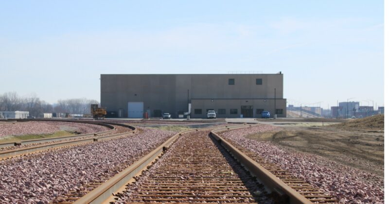
The Des Moines Area MPO spent years planning for a new transload facility, which has strengthened the connection between the region’s trucking and rail freight networks. Today, the transload facility is open and being operated by Des Moines Industrial.
Background
Greater Des Moines is among few metros in the country to be served by three national (Class 1) and one regional (Class 2) rail carriers, with freight networks stretching from coast to coast and the Mexican and Canadian borders. Only about 25 percent of U.S. shippers have direct access to more than one Class 1 railroad.
But until recently, there was limited connects between the robust rail network and the state’s vast farm-to-market network of roads and highways served by the trucking industry. In fact, there was only one transload facility where freight could be transferred between rail cars and semitrucks, and it is served by a single rail carrier, a so-called “captive” facility without competition.
The new transload facility is “non-captive,” served by multiple rail carriers, thereby increasing the capacity of rail freight and encouraging competition among rail carriers. This has the potential to significantly lower shipping costs and provide a significant boost to the regional economy.
The establishment of the transload facility was made possible by an $11.2 million Better Utilizing Infrastructure to Leverage Development (BUILD) grant that was secured by the Des Moines Area MPO. The MPO also helped secure a $1.7 million interest-free loan for the project from the Iowa Department of Transportation.
Site Footage
Past Reports, Studies, and Maps
DSM Railport – Feasibility Report – Final (June 28, 2014)
DSM Railport – Transportation Impediments – Final (August 2014)
DSM Railport – Market Analysis – Final (January 31, 2014)
DSM Railport – Rail Map 2014-08-05
Environmental Assessment – Des Moines Transload Facility (2020)
Appendix A: Wetland Delineation Report and USACE Review
Appendix B: Threatened and Endangered Species Habitat Evaluation (including IPaC) and USFWS Review
Appendix C: Floodplain Map
Appendix D: EDR Radius Map Report and IDNR Letter
Appendix E: SHPO Consultation, Cultural Resources Desktop Assessment, Phase IA Cultural Resources Survey, and Historic Structures Report
Appendix F: Tribal Consultation Letters

